PHOTOGRAMMETRIC SURVEY: how to generate a 3D model from photographs
The photogrammetric survey, despite being around a century old, is still a widely used survey technique with which you can obtain a cloud of points arranged in three-dimensional space, thanks also to technological development and…
Level of Development (LOD): the differences between the regulations of various countries compared
In order to implement this in the simplest and most correct way, the Levels of Development have been defined, (from the English “Level of Development” or LOD), that is, the definition parameters that the BIM model must achieve according to the final needs identified…
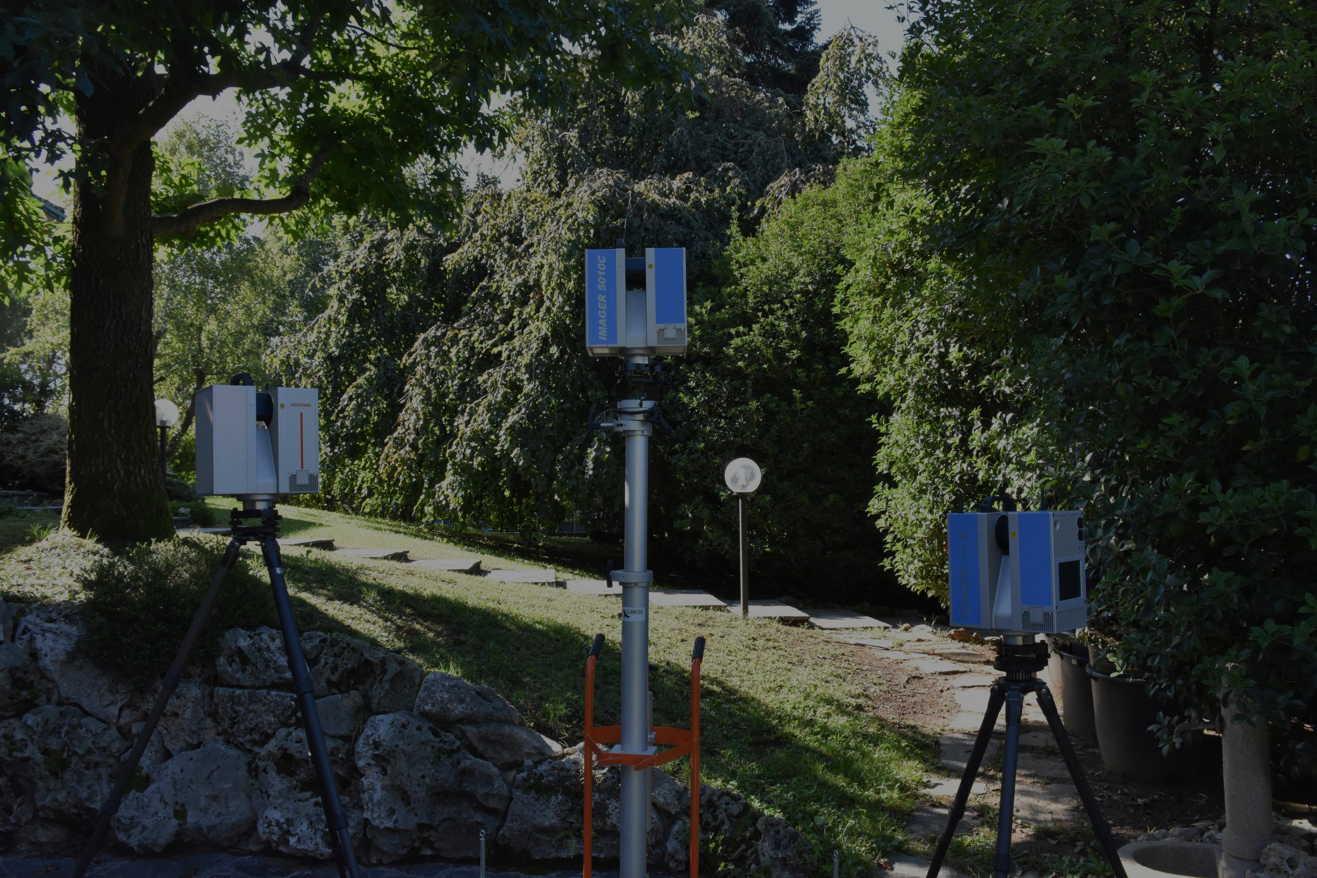
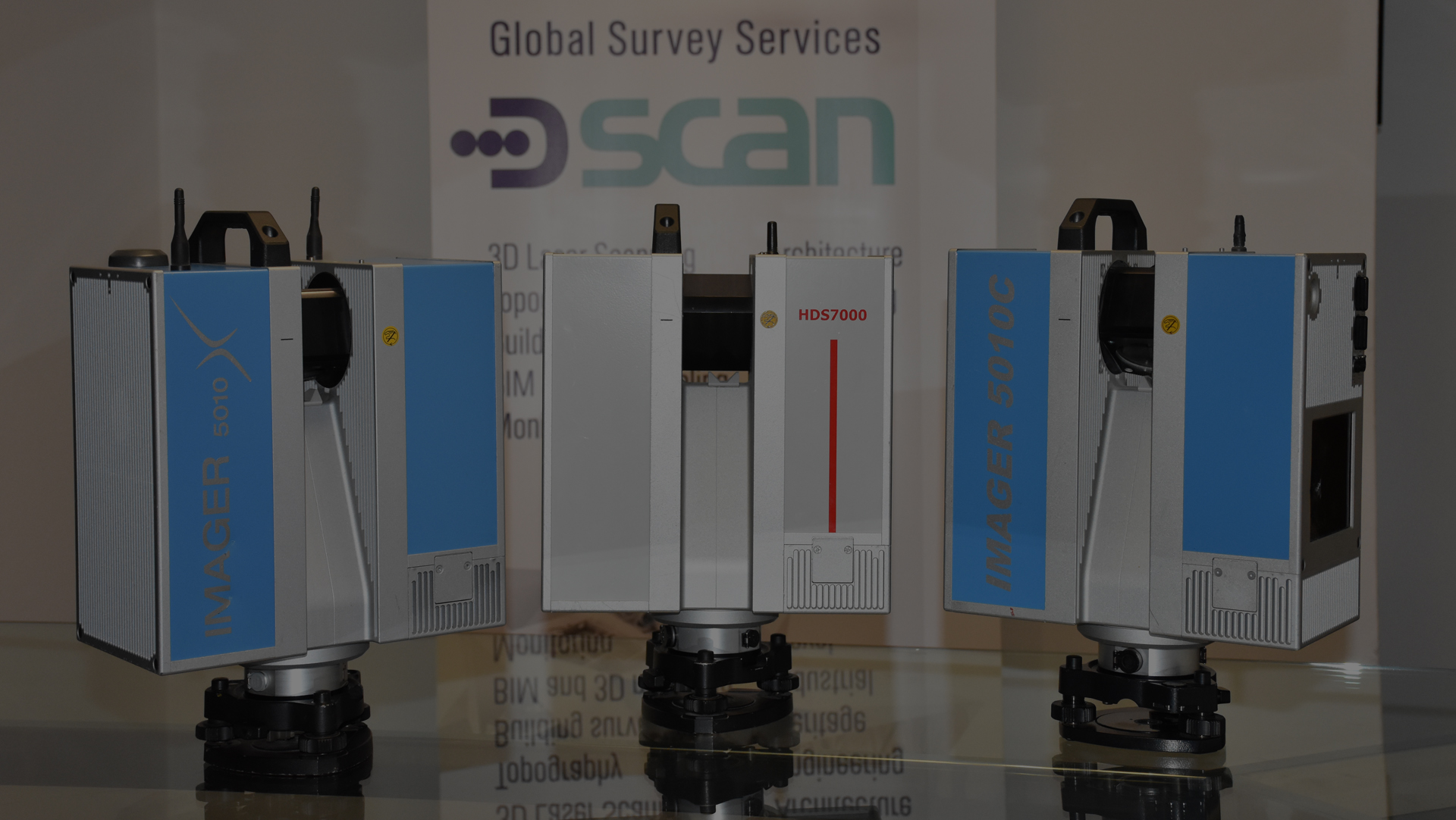
THE BEST INSTRUMENT: how to choose the scanner based on the needs of the survey
In every sector and in every market, even the world of 3D laser scanner surveys is composed of a series of companies that share the market by supplying increasingly technological, performing and competitive…
BIM OBLIGATION: from the 1st jenuary 2019 the decree that changes the cards on the table
We can call it the “digital revolution“, which began January 1, 2019 and will not stop for at least the next 7 ….
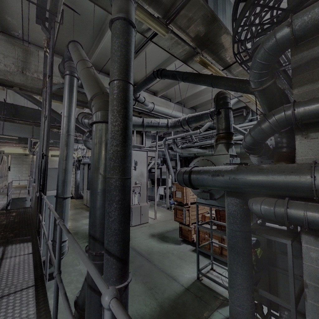
INDUSTRIAL REVAMPING: how a laser scanner survey can improve the useful life of an obsolete implant
It might seem trivial, but an efficient and modern machine is the necessary condition to increase the performance and flexibility of each production line, regardless…
5 ways to increase the survey accuracy
Perform a geometric survey to measure and represent land or a building, it is a complex process that requires professionalism and attention from the detector. From its choices and the way how the survey will be made depend the overall accuracy, and ultimately the quality of work. There are some basic rules that a surveyor…
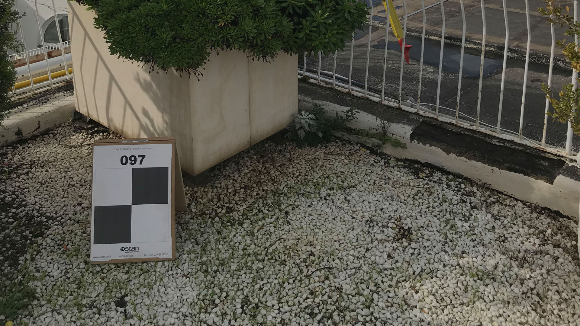
THE IMPORTANCE OF TARGETS IN A LASER SCANNER SURVEY
Carrying out a laser scanner survey is not as simple an operation as it might seem. Of course, compared to a few years ago, technology has helped this activity a lot, automating several processes and speeding up the timing, but it still remains…
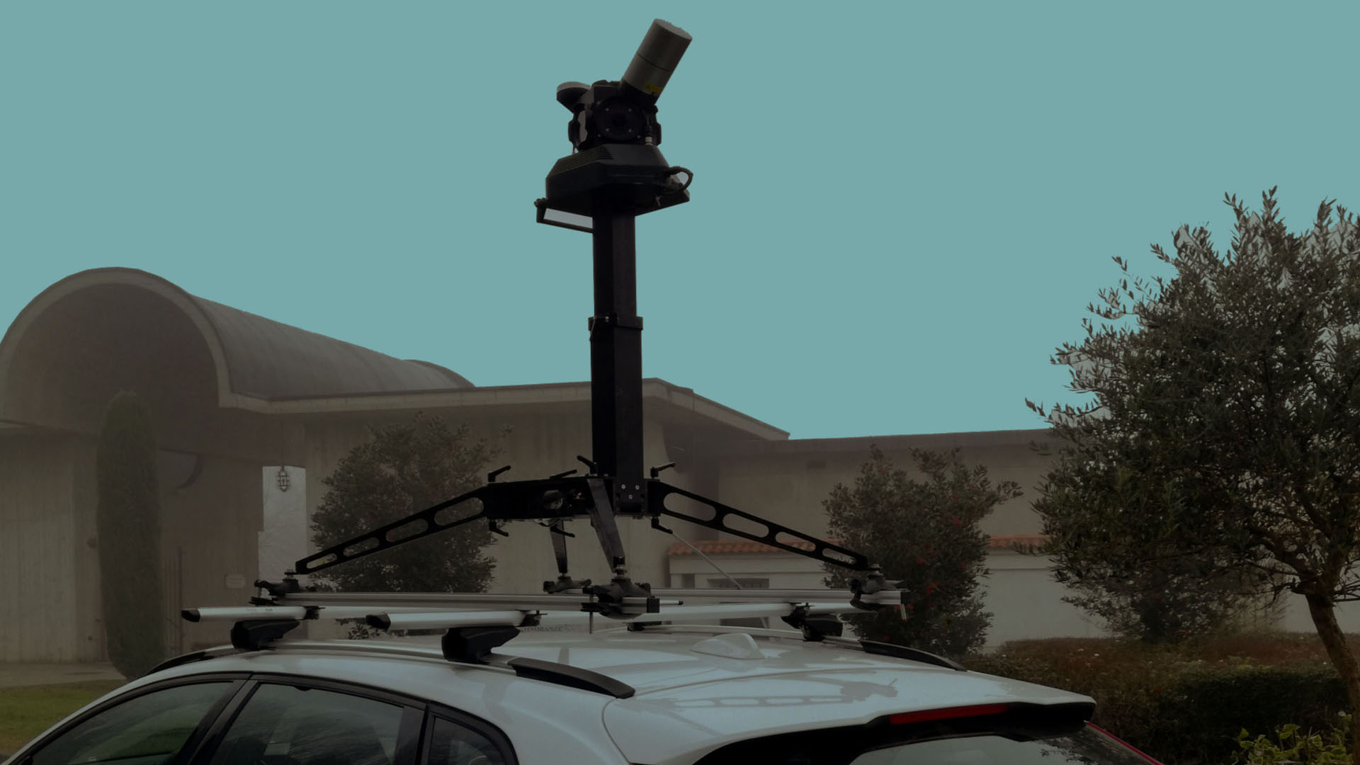
MOBILE SURVEY: the dynamic laser scanner surveys
In recent years we have seen continuous technological evolutions of tools, software, techniques and relevant methodologies, which have raised the level of work quality significantly.
Without a doubt, keeping…
What are the most common incidents during a 3D laser scanner survey and how to solve them?
Sooner or later, for those in the field of laser scanner surveys, it happens to everyone to come across some problems that can …
GAME OF DRONES: Permitted flight permit, or nearly so ... we go towards a new regulation for flying with drones.
In recent years, the rapid technological evolution, especially in the field of microprocessors and sensors, combined with the high performance for batteries and motors, has allowed the development of a new class of aircraft, proving to be a new and surprising….
A good survey: COST or INVESTMENT
One of our reference markets includes professionals from the world of architecture and civil engineering, who, as we are familiar with, designing at different scales and operating on the existing building heritage, logically should be, for us, a customer…..
Topographic survey or laser scanner? Two techniques compared.
Recently a client with whom we have never worked before, asked us to estimate the survey of a medium-sized hotel. The objective was to measure and represent the external areas, the shape of the building and the 4 elevations, which given the articulated shape of the various volumes, would not have been easy to …
THE IMPORTANCE OF TARGETS IN A LASER SCANNER SURVEY
To perform a laser scanner survey in the best way, the first thing to do is to identify an action strategy by planning every moment of the survey step by step in order to avoid improvisation, waste of time and errors.
Even the “logistics”…
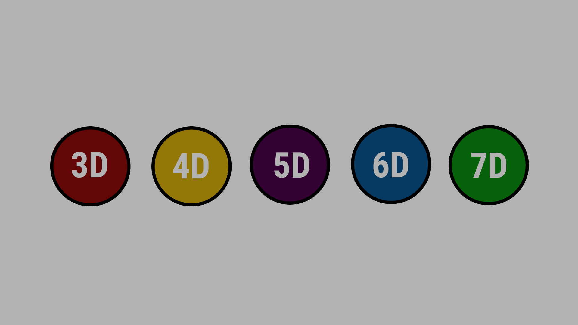
From Modeling to Management: BIM and 7D
BIM is now a consolidated reality in the world of architecture, engineering and beyond, but at the same time in continuous evolution.
We can define it as…
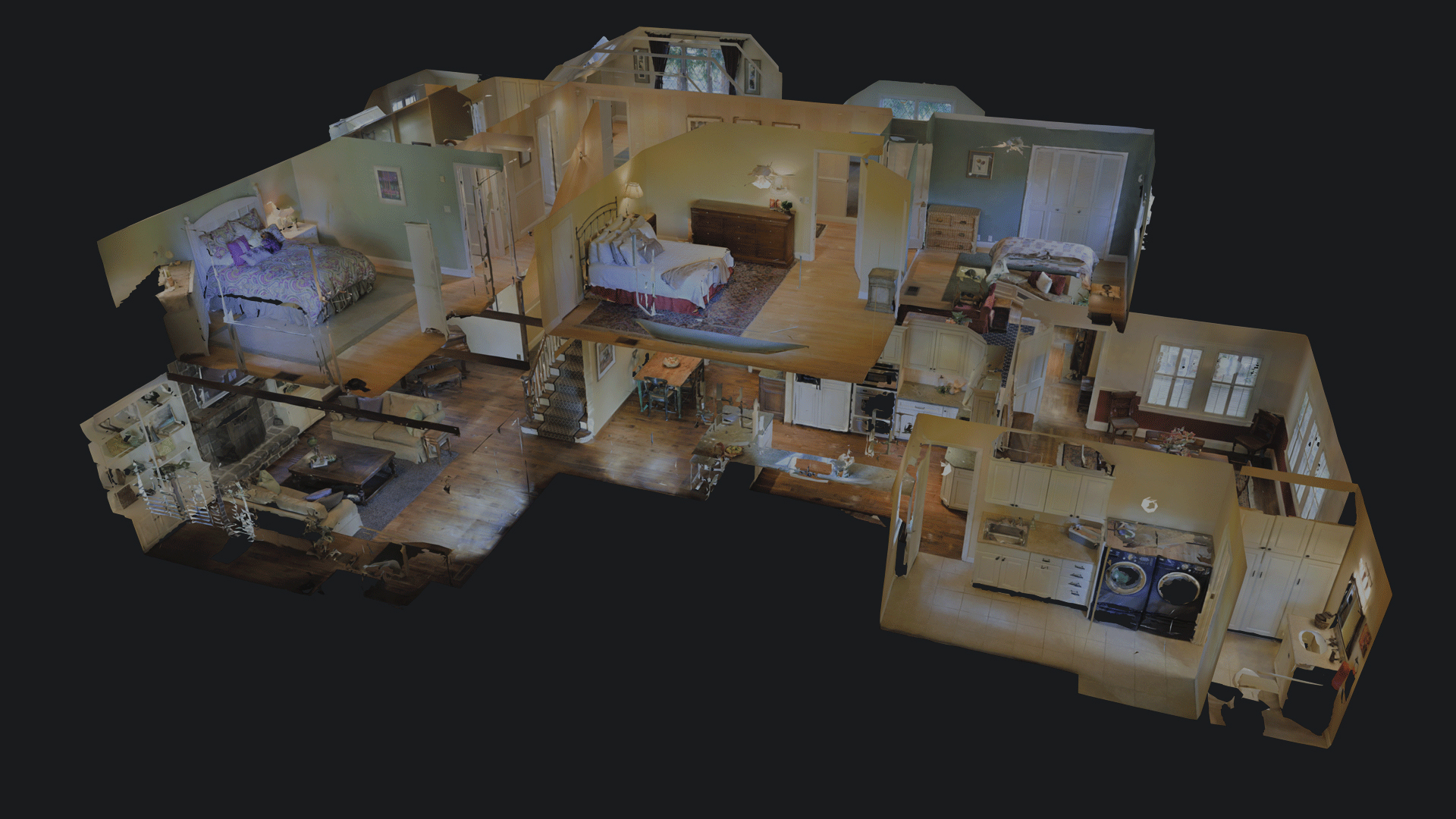
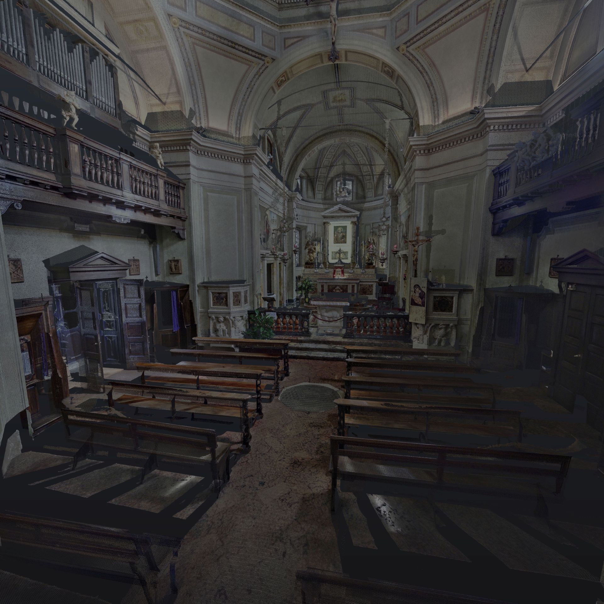
3D virtual tours: 8 reasons to use this new communication tool
Surveying by means of a 3D laser scanner is undoubtedly one of the most modern survey techniques, as it offers, in real time, the spatial coordinates of a set of points, called point cloud, belonging to the detected structure, from which it is It is possible…
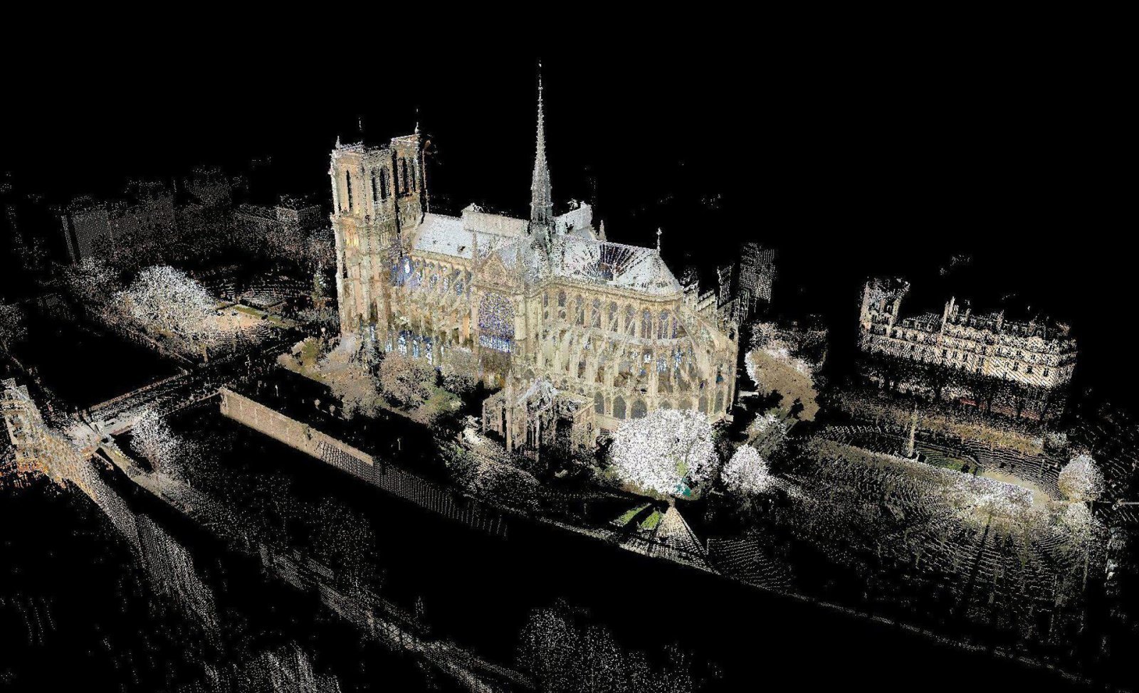
RESTORING BY SCANNING: the key to the reconstruction of Notre-Dame.
Notre-Dame, the most famous cathedral in the world, considered the main place of Catholic worship in Paris is in the hands of laser scanner technology.
Built over 800 years ago, the iconic cathedral in 1862 is recognized as…
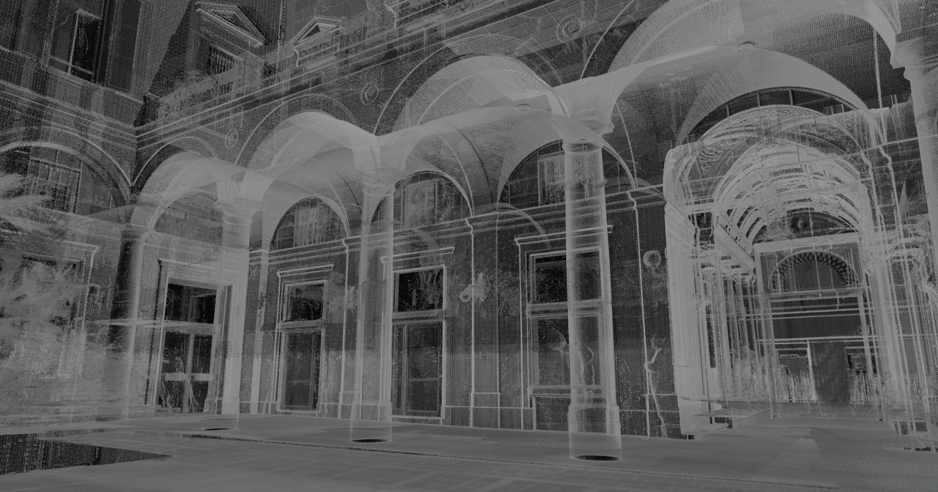
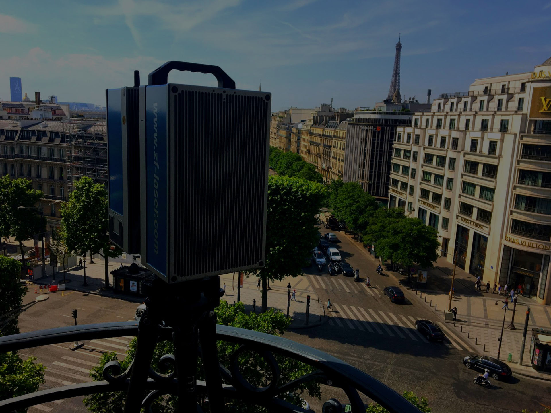
How does it work a 3D Laser Scanner?
For some years now, in the market of surveying and metrology, have made their appearance the 3D laser scanner that are increasingly being used for the acquisition of geometric information in various sectors and for different fields of application. This technology has greatly speeded up the phase of acquisition of 3D coordinates that define the…
How much cost a 3D Laser Scanning survey?
The first question that potential and already established custome ask us when they are looking for laser scanning services is: “How much it cost a 3D Laser Scanning survey?”. It is certainly not easy to determine the cost of a survey, since there are a very large number of variables that come into play when…