How much cost a 3D Laser scanner survey ?
September, 24, 2019
Topic: Laser Scanner, Business
( 9 min read )
The first question that potential and already established custome ask us when they are looking for laser scanning services is: “How much it cost a 3D Laser Scanning survey?”.
It is certainly not easy to determine the cost of a survey, since there are a very large number of variables that come into play when evaluating the cost of an assignment, we will still give in this post some useful information that allow you to make an idea on how to quantify cost.
As we say in another post, the pros of using 3D laser scanner than traditional survey techniques are the optimization of data acquisition and at the same time the fact that you can be sure to acquire all the necessary information you need to represent the measured object. By the way there are many variables that must be taken into account when estimating the cost of a laser scanner survey, and among these the most important are:
- Morphological characteristics of the building/plant/object;
- Overall size;
- Need to acquire in addition to the X,Y,Z information also those relating to materials/colors;
- Level of accuracy required by the customer;
- Level of detail required;
- Deliverables;
Morphological characteristics
The external form, the distribution of the interior spaces, the extension on multiple levels, the presence of complex decorations, are all factors that affect the cost of survey activities.
To estimate the right cost, it’s important to have a precise idea of the object’s characteristics performing an inspection or viewing photographic documentation supplied by the customer.
Dimensions
That dimensions affect the cost of a survey might seem obvious, and in fact in general terms, the larger the object, the more time is required to detect it, the higher the cost.
However, there are some considerations to make on the subject.
First, the size of a property has to be considered in relation to its morphological characteristics, to survey and represent an industrial building open space of 10,000 square meters could cost less then the survey of an historic residential building on several floors of the total area of 1,000 sq.m..
Furthermore, a linear increase of the size of the property, not generally corresponds to a proportional increase in the cost, for obvious reasons linked to economies of scale.
Materials and color information
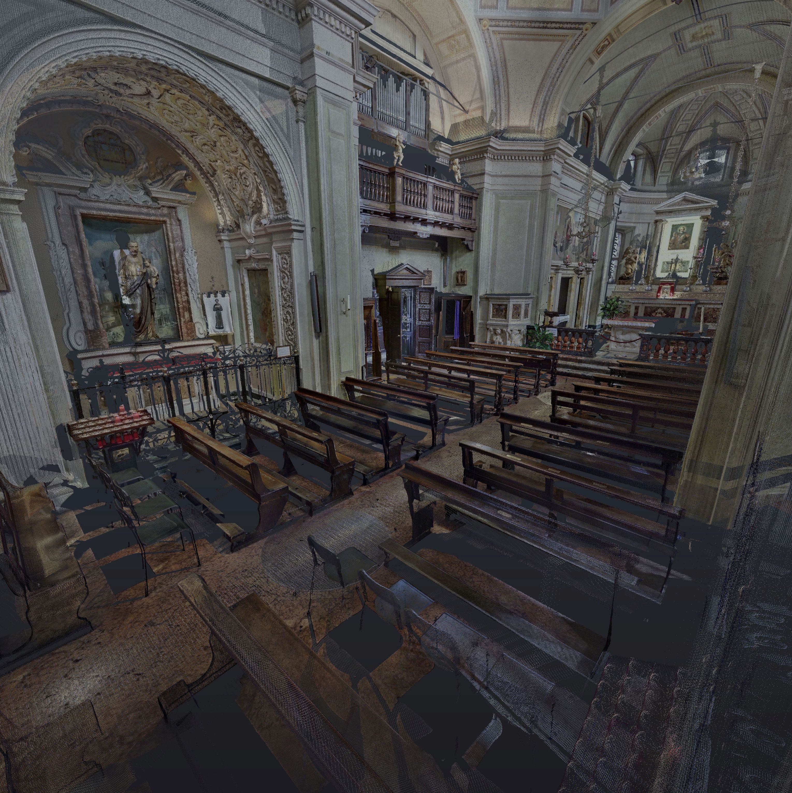
Using a 3D laser scanner with integrated digital camera, allow to captures in addition to geometric information also those relating to the color and material. The application of digital images on point clouds, allowing to deliver processed orthophotos, textured color facades, analysis reports of degradation etc.
The acquisition of this type of information during the scanning phase and the postprocessing of the data for the mapping of colors on point clouds, prolongs the time of data acquisition and postprocessing with consequent increase of costs, therefore it is appropriate to evaluate the real need for the customer.
Level of accuracy
When we talk of greater or lesser survey’s accuracy we talk about the degree of correspondence between the measurements and their ‘true value’. There are survey techniques that help increase the overall accuracy, and which require the use of high-precision instrument.
The 3D laser scanner on the market, enable to obtain an accuracy sufficient for the vast majority of applications, but if necessary their use can be integrated with topographic total station.
Level of detail
This aspect depends solely on what the customer expects to be measured and accounted for and the purpose for which the survey is commissioned. It ‘s always important, before a cost estimate, ask what will be the future use of the deliverables to be produced.
To give a practical example, the survey of only the total volume of a property and the architectural survey with return at 1:50 of the same property, will result in time, resources and costs considerably different.
Deliverables
The phase of restitution and representation of the object measured by a 3D laser scanner, usually turns out to be the longest phase and wasteful in terms of working hours. It is preceded by a stage of processing of the raw data obtained from the scanner, which is done through the application of appropriate processing filters, the possible application of the mapping of color, the registration of the clouds and the export of data in formats readable by 2D/3D CAD softwares.
Then we proceed to build the deliverables itself, through the creation of two or three-dimensional drawings depending on the request, and additional materials such as reports of survey, material schedules, virtual tours with 360° panoramic images, rendering, video and animations.
Also in this case, will be important to understand the customer needs and the use he will do of the final output.
Conclusions
As we have seen, there are many aspects that must be analyzed before we can properly quantify the cost of a significant activity.
The interview and consultation phase with the customer is crucial to identify the precise objectives and the detailed specifications to perform the work in the best way and guarantee customer satisfaction.